SERVICE
해상풍력의 혁신, 바다엔지니어링에서 시작됩니다.
Geotechnical Analysis & Consulting
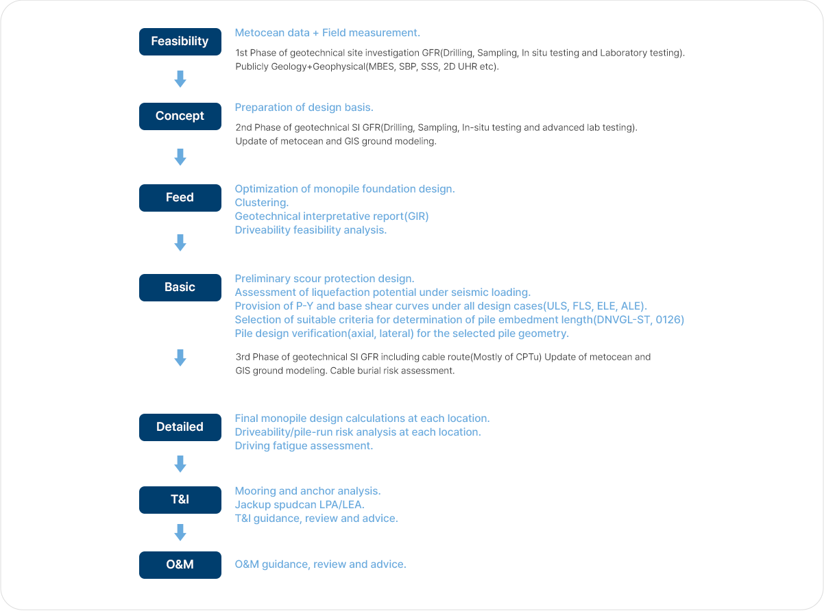
Geotechnical related Activities in Offshore Windfarm Development
Ground Modelling
Integrated ground model is a comprehensive report that includes/integrates all available site characterization data including such as geological, geophysical and geotechnical datasets, and interpretative data such as soil province, soil parameter profiles and geohazard assessments. The GIS compatible ground model is updated throughout the life of the wind farm development making it a useful tool for assisting micro siting for WTG foundations and providing options for foundation design, construction and installation stages as well as for planning of OWF development during FEED stage. The BADA Engineering use Esri’s ArcMap GIS software, which allows for rapid viewing and interrogation of the various datasets and interpretative information. Comparison between geotechnical and geophysical data is very important to improve the interpretation of the stratigraphy across the windfarm site, namely the depth of occurrence of the weathered rock layer, which will be key for the planning of the upcoming phases of the project (e.g. Geotechnical Site Investigation, Monopile Design, Driveability feasibility analysis, etc.)
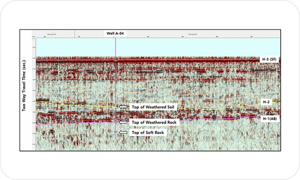
Seismic interpretation along seismic lines passing
through borehole locations
Geotechnical Interpretative Assessment
The data from the available cross-sections, existing geotechnical investigation report and results from the upcoming geotechnical investigation at WTG locations will be integrated to determine the stratigraphy and geotechnical parameters per each soil units at each envisaged turbine location. Typical Geotechnical Interpretative Report (GIR) suitable for offshore wind foundation design purposes shall include.
- - Undrained shear strength in cohesive soils
- - Peak drained friction angles in granular soils
- - Small strain shear modulus
- - Parameters related to interface between soil and steel
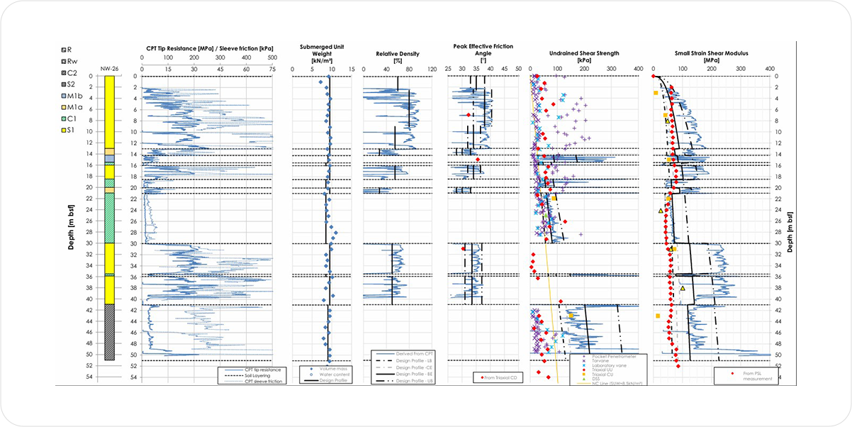
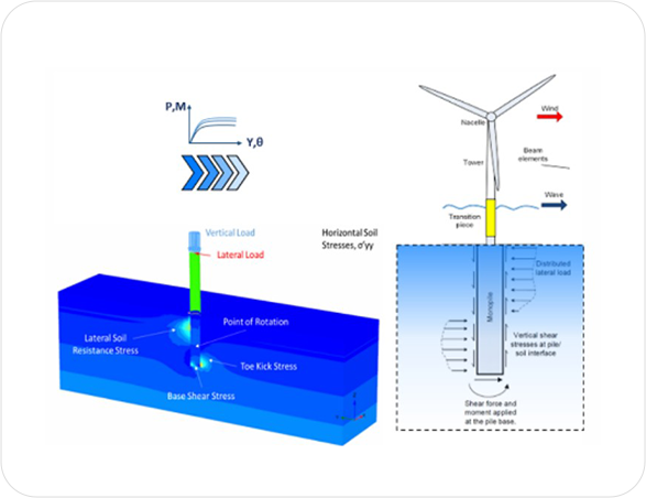
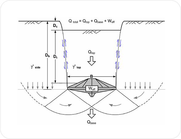
Characteristic Ground Profiles for Monopile Lateral Analysis
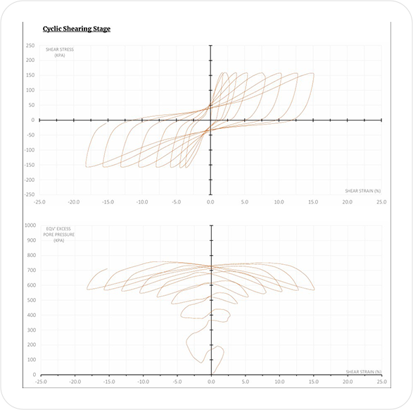
Cyclic Direct Simple Shear
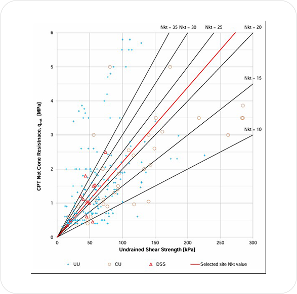
Undrained Shear Strength vs. Net Cone Resistance
Geotechnical Design
The offshore foundation design for OWF is mainly carried out through concept, FEED, and detailed design, and various disciplines such as geotechnics, structure, and hydromechanics etc. are applied in a complex manner. In particular, the monopile is governed by the frictional force of the pile, and the strength of the adjacent soil decrease due to cyclic loading (wave, blade etc.) during the design life, so it requires a high level of expertise and experience in the geomechanics area.
Optimization based on Experience and Latest Analysis
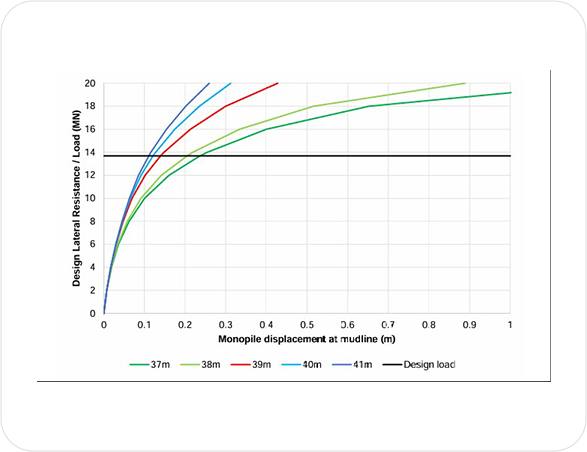
Plot considering design low estimate soil profile
and cyclic p-y curves
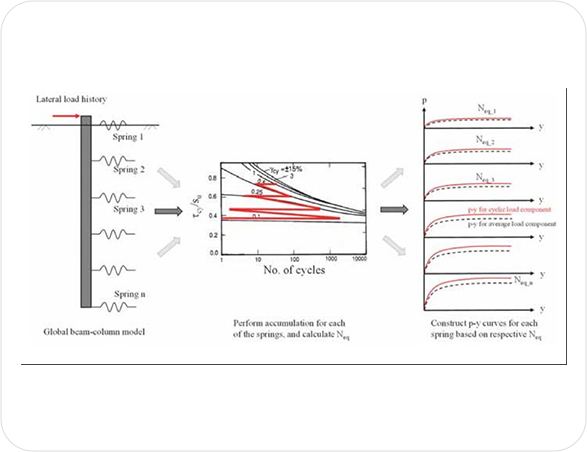
Illustration of the entire process of cyclic
shear strain accumulation
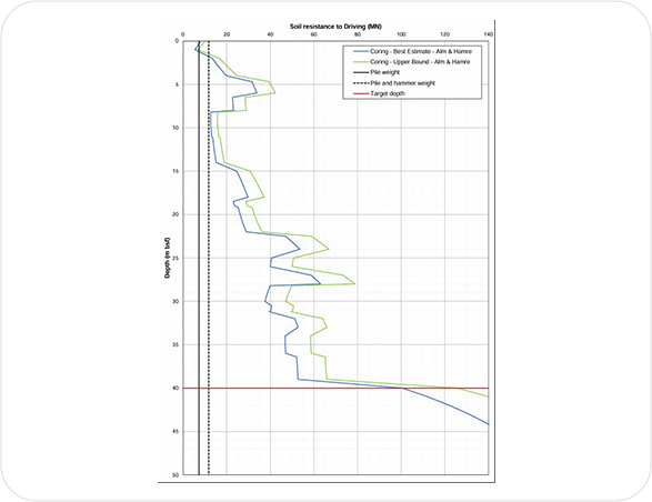
Soil Resistance to Driving vs. Depth
Geotechnical Application to the Offshore Windfarm
The scope of geotechnical related support in the development of OWF Is not limited to providing GIR and geotechnical design for WTG foundation design. One of the most common issues that can arise during T&I of monopile is the stability of the jackup installation vessel on soft and thick clay/silt ground due to penetration/extraction of spudcan, and scour protection around foundation.
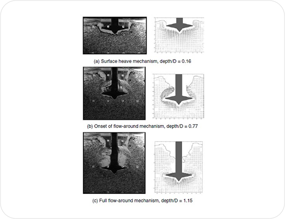
Displacement Vectors and Simplified Failure
Mode of Spudcan
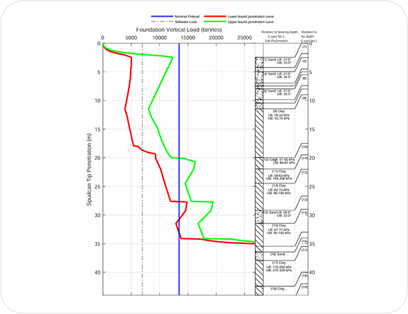
Jackup Leg Penetration Analysis
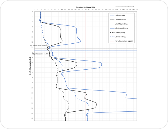
Short Term Leg Extraction Analysis
Characteristics of the Surrounding Seabed
Behavior due to Spudcan Penetration/Extraction
COPYRIGHT ⓒ 2024 주식회사 바다엔지니어링. ALL RIGHTS RESERVED. Designed by WebSite.co.kr